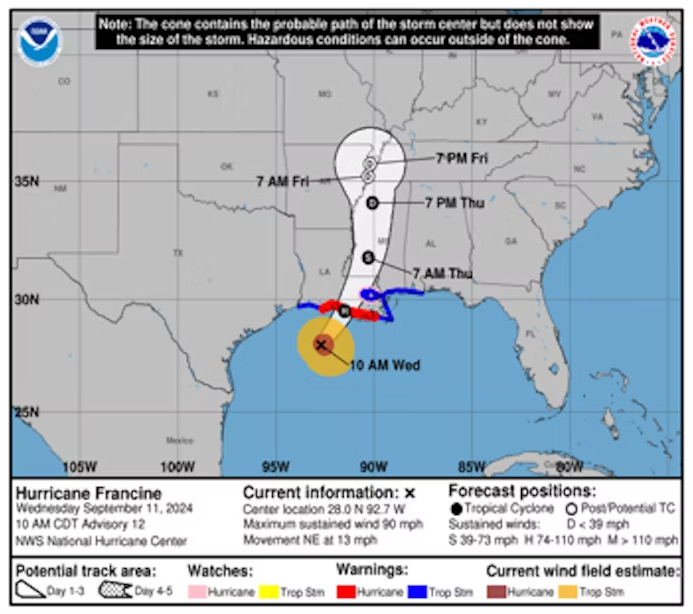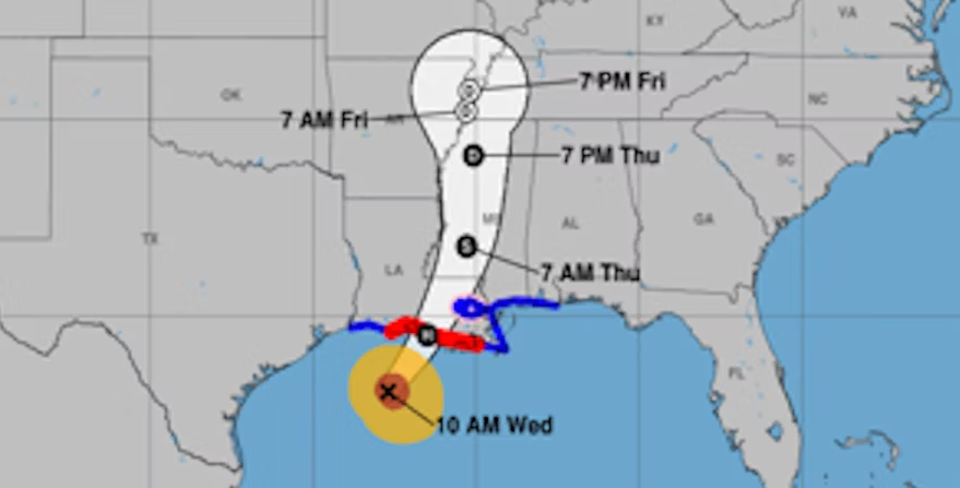
Hurricane Francine is expected to hit Louisiana this evening, bringing destructive winds, dangerous storm surges, and heavy rain. The storm’s effects are anticipated to extend north into the Mid-South by the week’s end.
As Francine makes landfall in south-central Louisiana tonight, severe weather conditions will likely impact cities such as Lafayette, Baton Rouge, and New Orleans. Threats include storm surges, strong winds, heavy rain, and the potential for tornadoes.
The National Weather Service has issued warnings about:
- Roads blocked by debris, especially in urban or forested areas
- Bridges, causeways, and access routes becoming impassable
- Widespread power and communication outages
- Some areas becoming uninhabitable for weeks
- Significant roof damage to solid structures, with some buildings experiencing door, window, and structural failures
- Severe damage to mobile homes, some of which may be destroyed
- Damage worsened by airborne debris
- Large trees being snapped or uprooted, as well as blown-over fences and road signs
The most intense winds and storm surges are expected near Francine’s center in south-central Louisiana. However, heavy rainfall and the risk of tornadoes will affect areas further east along the central and eastern Gulf Coast, including southern Mississippi, Alabama, and the Florida Panhandle.
Francine is forecasted to bring 4 to 8 inches of rain, with some areas receiving up to 12 inches along the central/eastern Gulf Coast by Thursday night. This could result in significant flash and urban flooding.
As Francine moves north into the Mid-South and weakens later in the week, more heavy rain could cause scattered flash flooding. Additionally, a stalled frontal boundary across Florida may lead to localized flooding over the coming days.
Residents in hurricane-affected areas should heed local officials’ advice, follow evacuation orders, and avoid driving through flooded roads.